peyotepictures@yahoo.com
% 415 577 1593 cell
% 415 255 7257 home
is coordinating this stage of the search.
John McKune , JMcKune@SpaceImaging.com (13 Nov 2001):
It's taken me quite a
while to sift through all the imagery we've collected. I have seen several
boats on the water (mostly motorized). We even caught a airplane in flight.
But very few candidate targets for the LUN, except for one... What I want
you to look at doesn't really look like much, but it's basically the correct
dimensions and color and appears to be drifting on the surface. It's
located just off a small island near the larger Achill Island.
Coordinates are (Lat 53:57:25 N, Lon 10:06:12 W).
I have several images to show you at various scales. Since some people have e-mail size limitations, I plan to break these into separate transmissions. Hopefully you can read PowerPoint (.ppt) files. If not, this e-mail contains the final .gif. The other three e-mails will contain: 1) Four zoomed images (2) Two zoomed images (3) An image containing autos for scale. (Gael forwarded this Power Point file and this GIF image ).
It's been nearly two weeks since this image was captured, so if this is a boat, it will have certainly moved by now, but probably onto shore in the general area. Of course, this could be somebody else's boat or not a boat at all. But it seems worth checking...
Predrag: Power Point image is the large area perspective, GIF file is zoom deep into the area marked on the Power Point image. Takes a real expert to identify this as potential Lun...
Jenifer Clark: I do think the image looks like it could be Lun. Satellite imagery is blocky by nature because it takes an area and resolves it as one data point. If that is Nenad's boat, it is upright since the bottom is gray and the top is yellow. We are working up possible search areas based on the siting at about 54N 10W from about 2 weeks ago. There is a slim chance that he could still be alive in the boat if his desalinator is working.
Jenifer Clark:
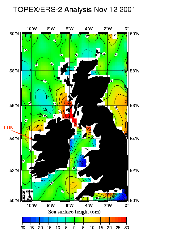
On Gael's report of the satellite possible confirmation of the boat near 54N
10W, the winds during the past several weeks were from the west mainly which
would push him near the shore line of Achill Island. Maybe they can get a
helicopter to scan the shore line all along there to Donegal Bay. The
currents would also indicate movement to the northeast. I am attaching a map
of the altimetry data analysis for the area.

Jenifer Clark:
I think a private helicopter has GOT to be found somewhere
to search the coastal area if the coast guard will not do it. Maybe
Ellen's dad could call the Irish Coast Guard and ask for a
helicopter to search the area. Dane, my husband, says the forecast near
Ireland for the next 4 days looks great as far as winds go. Fog could be a
problem and we are not familiar with the local conditions.
(Irish coastal weather)
Roko Belic:
List of rescue contacts